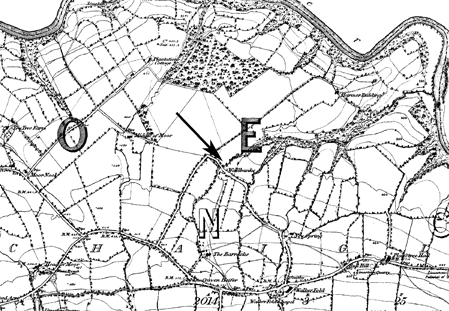
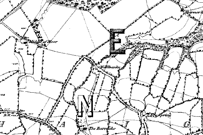
Wallbanks farmstead near Clitheroe is shown on the 1847 Ordnance Survey map.
It is located on a stream which flows into the River Hodder at the north-east edge of the map.
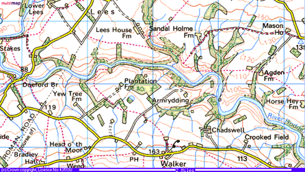
After about 1975 the name disappeared from OS 1:50000 maps(below).
Modern 1:50000 OS map. Wallbanks farmstead is located on the footpath and stream south west of Armrydding farmstead. The name is no longer shown on this map but is still shown on the latest 1:25000 OS map.